|
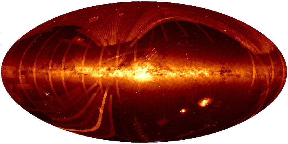
This image of the sky is a representation of the density of the objects accessible in VizieR, in galactic coordinates
(the Galactic center is in the middle of the image, the galactic longitude is increasing toward the left).
The above image uses more than 7.500 tables included in VizieR; the large surveys (GSC, USNO, 2MASS, UCAC2, NVSS) have been removed to point out the zones deeply studied.